
Description
Day
01:
Arrival in Kathmandu [1,300m/4,264 ft]
Upon our arrival in the Tribhuwan
International Airport (TIA) in Kathmandu, we will be greeted by a
representative from Red Dragon Travel Bureau who will drop us off at our hotel.
After checking in, we take a rest or visit Red Dragon Travel Bureau’s office.
We may also stroll in the streets of Thamel, a tourist hub in Kathmandu for
some souvenir shopping. In the evening, there will be a welcome dinner hosted
by Red Dragon Travel Bureau where you will be served excellent authentic
Nepalese cuisine which will introduce you to the country's food culture.
Overnight in Kathmandu.
Day
02:
Kathmandu: Sightseeing and Trek Preparation
Today after breakfast we start a guided
tour to several of the most historical and spiritual attractions in Kathmandu.
Some of these landmarks including the historic Durbar Square, the sacred Hindu
temple of Pashupatinath, the famous 'Monkey Temple' (Swayambhunath) and
Buddhist shrine (Bouddhanath) which is one of the largest stupas in the world
are listed as the UNESCO World Heritage Sites. There will be a brief pre- trip
group discussion followed by trek preparation during late afternoon at Red
Dragon Travel Bureau’s office in Thamel around noon. Overnight in Kathmandu.
Day
03:
Drive from Kathmandu to Sotikhola [710m/2328 ft] 8 - 9 hours
We set off early today for Sotikhola.
During the drive, we enjoy views of the Nepalese countryside along with the
mountain sceneries. We will be driving on a paved road from Kathmandu to
Dhading Bensi, district headquarter of Dhading (1050m) but the drive from
Dhanding Bensi to Arughat will be on a rough road. Upon reaching Arughat, a
major town in the region we drive further towards Sotikhola. Overnight in Soti Khola.
Day
04:
Soti Khola to Maccha Khola [900m/2952 ft]: 6 - 7 hours
At the crossing of the bridge, we trek
through the beautiful Sal forests, then climb onto a ridge above huge rapids on
the Budhi Gandaki. We then reach Khursane upon which the rocky trail weaves its
way up and down, past two tropical waterfalls on a steep, rocky trail clinging
to the side of a cliff. It eventually makes its way down and past a few rice
terraces, then up and around to the Gurung village of Labubesi. We further
climb behind a rocky outcrop, where the valley opens up and the Budhi Gandaki
meanders among wide gravel bars. Dropping to the sandy river bed, we walk along
rounded stones before climbing over a side ridge. We head down again to the
river and cross another suspension bridge to reach Machha Khola village.
Overnight in Machha Khola.
Day
05:
Maccha Khola to Jagat [1410m/ 4625 ft]: 6 -7 hours
The narrow trail makes some minor ups
and downs and eventually crosses the Tharo Khola and reaching Khorlabesi. After
a few more ascends and descends we come across a small Hotspring in Tatopani.
From the hot spring, we climb over another ridge, then cross the Budhi Gandaki
on a suspension bridge. At this juncture, we climb on a wide, well-crafted
staircase, then across a landslide and over a ridge to Dobhan. Upon crossing a
suspension bridge over the Yaru Khola, we climb the stone stairs and then drop
to the river and again climb more stone stairs to Tharo Bharyang. Crossing the
west bank of the Budhi Gandaki, we climb over a ridge, trek along the river and
then climb towards the village of Jagat. Overnight in Jagat.
Day
06:
Jagat to Deng [1,804m/5917 ft]: 6-7 hours
We begin today’s trek by climbing over a
rocky ridge to Salleri, and then descend to Sirdibas. The valley widens a bit
as the trail continues up to Ghatta Khola. We further continue walking upstream
to a long suspension bridge in Philim, a large Gurung village. The trail turns
north just above the lowest house in the village and stays on a fairly level
trail as it crosses millet fields to Ekle Bhatti. The route now enters a steep,
uninhabited gorge. At this point, we descend to the grassy land slopes, cross
the Budhi Gandaki, then trek along the west bank for a while, then cross to the
east bank and then back again. As we continue through the trail the valley
widens and we pass through bamboo forests to the Deng Khola. Upon crossing the Khola, we reach the tiny
village of Deng. Overnight in Deng.
Day
07:
Deng to Namrung [2630m/8626ft]: 6 - 7 hours
After a brief walk beyond Deng, we cross
the Budhi Gandaki and climb to Rana village at 1910m. From the bridge, we climb
a bit to join a trail from Bhi, then head west up the Budhi Gandaki valley. The
trail also passes through forests and mani where we turn towards a corner that
contours to Ghap. Even though there is another route, we take the route through
Prok village. Prok village has a viewpoint for a beautiful sight of Siringi
Himal. We further cross the Budi Gandaki several times today and come across a
few gompas en route. The trail follows the river upstream through a dense
forest. After crossing the river at an impressive spot where it thunders down a
narrow gorge, the forest becomes less dense and the trail is fine again. The
pleasant walk continues and after a last steep climb we reach Namrung.
Overnight in Namrung.
Day
08:
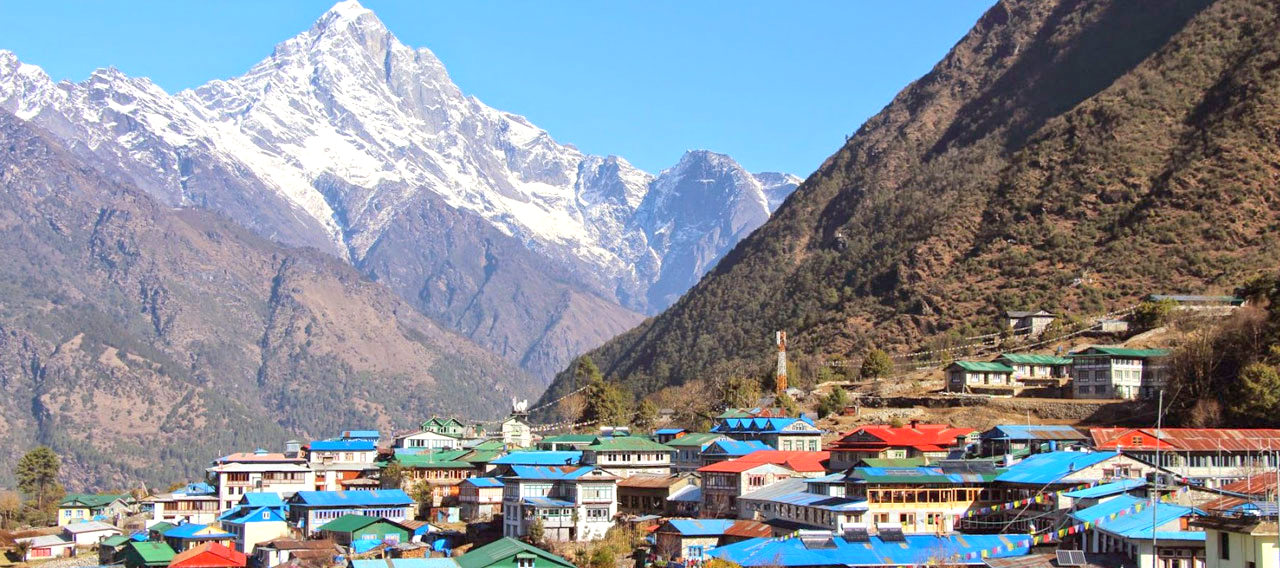
Namrung to Samagaon [3530m/11,578 ft] 6-7 hours
Namrung village is a good viewpoint for
Siring and Ganesh Himal and from the village one can also see Mt. Himal Chuli
in the south. We climb steadily and pass through forests and reach Lihi, a fine
village with many chortens and barley terraces. The trail drops and crosses the
side valley of Simnang Himal with Ganesh Himal always close by. We further pass
through Sho, Lho and Shyala villages before reaching Sama Village. We enjoy
extraordianary views of Mt. Manaslu from Lho village and also explore the
famous Ribung Gompa. In Shyala village we will be surrounded by high mountains
like Himal Chuli and Peak 29 (Ngadi Chuli) to the left, Manaslu and large
glaciers straight ahead, and other snow summits to the right, and at the far
end stands Ganesh Himal. Today’s journey ends in Samagaon where we spend the
night.
Day
09:
Samagaon to Pungyen gompa return to Samagaon: 6 - 7 hours exploration
We spend the day at Samagaon both for
rest and acclimatization. Today, we get acquainted with the rich Sherpa
culture. We enjoy the sight of thousands of mani stones with Buddhist texts and
pictures and the Sherpa women clad in traditional clothes and ornaments. On a
little hill near the Sama village is an old Gompa (Pungyen Gompa), a monastery
with great views of the glacier. It is named after Manaslu, Pungyen means
bracelet, a good description of the two peaks. It was destroyed a year after
the first unsuccessful Japanese attempt to climb Manaslu. The locals believed
that the climb angered the gods, and when the Japanese came back a year later
they met with a lot of resistance that they had to give up their attempt. They
were finally successful in 1959. Overnight in Samagaon.
Day
10:
Samagaon to Samdo [3860m/12,660 ft]: 4 - 5 hours
Today, we descend to the Budhi Gandaki
River, that has turned north and follow it to a bridge over a side stream. The
trail to the left leads to the Manaslu Base camp. The Larkya la Trail passes
several mani walls as the valley begins to widen. It is an easy trail on a
shelf above the river passing the juniper and birch forests of Kermo Kharka. We
drop off the shelf, cross the Budhi Gandaki on a wooden bridge and climb
steeply onto a promontory between two forks of the river. From a stone arch we
can view a large white kani. Finally passing through the kani we find Samdo.
Overnight in Samdo.
Day
11:
Rest Day in Samdo
This is another day set aside for proper
acclimatization. There are two options for us today. The option that we highly
recommend is a hike, up the valley directly at the back of the Samdo village.
This hike will take us to one of the trade passes to Tibet for excellent views
of Mt. Manaslu along with other Himalayan ranges including Simrang, Hiunchuli,
Ngadi, Larkye Peak, Cheo and possibly Kang Guru behind the pass. En route to
these viewpoints we pass many seasonal herding settlements called doksas and
sight some beautiful mountain birds like the Lophophorus (the national bird of
Nepal), Lammergeyer and Himalayan Griffin soaring high above us. Another option
for today could be a trip to the Gya La ('large pass') to the north of Samdo, a
more frequently used trading route to Tibet. But, this is a rather longer hike
(whole day) and hence could be a little tiring. Overnight in Samdo.
Day
12:
Samdo to Dharamsala/Larkya B. C. [4460m/14, 628 ft]: 4 - 5 hours
Even today, we continue our walk down
the edge, cross the wooden bridge over Budi Gandaki and begin walking upward.
Upon crossing two streams and witnessing the Larkya Glacier we go around the
valley of the Salka Khola and climb up again to the stone guest house (4450 m),
which is not a lodge but a kind of shelter called Dharmshala, also known as
Larke Phedi. The short walk today also leaves plenty of time for
acclimatization and relaxing in the afternoon. Overnight in Dharmashala.
Day
13:
Dharamsala to Larkya la [5160m/16, 924 ft] to Bimthang [3720m/12, 201 ft]: 8 -
9 hours
After a short climb, we reach a valley
on the north side of the Larkya Glaciers from where we can enjoy great views of
Cho Danda and Larkya Peak. Finally, we walk across moraines of the glacier,
making a gradual ascent which becomes steeper only in the last section of the
pass. From the pass, there are outstanding views of Himlung Himal, Cheo Himal,
Kangguru and the huge Annapurna II. It is a longer day than usual to Bimtang,
but to walk into these low pastures with the evening mist coming in with Mt.
Manaslu looming close by is an overwhelming experience. Overnight in Bimthang.
Day
14:
Bimthang to Tilije [2300m/7544ft]: 5 - 6 hours
From a ridge at Bimthang, we can enjoy
great views of Mt. Manaslu, Lamjung Himal, Himlung Himal and Cheo Himal. We
descend further and cross a high pasture (Sangure Kharka) followed by a bridge
over Dudh Khola. We walk through rhododendron forest and follow a trail through
a narrow valley until we reach the highest cultivated land of the valley at
Karche, 2785 meters. We pass across fields before making a steep climb over a
ridge. The trail comes off the ridge in a big, sweeping arc to the river bank
at 2580m. A short distance beyond is the village of Gho. Due to yesterday's
tiredness we might take an overnight rest at Gho but better lodges are
available at Tilije, so Red Dragon Travel Bureaurecommends we stay at Tilije.
Overnight in Tilije Village.
Day
15:
Tilije to Chame (2,710m/8,891ft) 6-7 hours
From here onwards we join the classic
Annapurna trail. From Tilije we descend first then cross a suspension bridge
and ascend until we reach Thoche village. After which we follow a fairly
straight trail and come across a Power House for electricity production in
Bagarchhap village. On the way from Bagarchaap to Chame we negotiate a few
steep forested ridges, along with several landslides on route. Remember to look
up though, as you will be rewarded with sensational views of some of the major
Himalayan peaks like Lamjung Himal, Annapurna II, and Annapurna IV
(7,525m/24,688ft). Overnight in Chame.
Day
16:
Chame-Pisang (3,700m/12,139ft): 5-6 hours
A steep, narrow path through a very
dense forest will bring you to the dramatic curved rock face, rising 1500m from
the river. As the trail opens up you will be surrounded by majestic Himalayan
Peaks. Overnight in Pisang.
Day
17:
Pisang to Manang (3,500m/11,482ft): 4-5 hours
Enter the upper Manang region, where you
will notice a contrast with the landscape and vegetation. The cold, dry climate
creates a much harsher environment. We also get to witness incredible views of
the towering Himalayan Peaks. Overnight in Manang.
Day
18:
Manang to Siri Kharka (4060m/13,320ft): 4-5 hours
From Manang we head out through the
western gates and follow the path down to the river. We cross the river and
continue walking on the south side of the river through coniferous forest
towards Khangsar village. From Khangsar we move further towards Siri Kharka and
pass a monastery on the way. The uphill walk could be tiring but we will have
Gungang Himal and Mt. Chulu in the backdrop to keep us company. Overnight in
Siri Kharka.
Day
19:
Siri Kharka to Tilicho Base Camp (4140m/13,583ft): 5-6 hours
From Siri Kharka to the Tilicho Base
Camp, it's mostly going downhill, but it has landslide areas that can be
dangerous. They're not difficult to walk, but the trails are very narrow. The
trail goes through the middle of the landslide area. The rock formations along
the trail are very impressive. Overnight in Tilicho Base Camp.
Day
20:
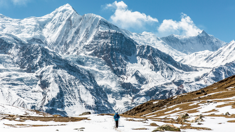
Visit to Tilicho Lake (4,949m/16,138 ft) then back to Siri Kharka: 5-6 hours
From Tilicho Base Camp the path
continues up along moraine ridges and grassy slopes to some large switch backs
carved out of the slope. We then reach the watershed. On the other side is
Tilicho Lake, a large spectacularly set lake nestled at the foot of the north
face of Tilicho Peak, part of the snowy wall that the 1950 French expedition
team referred t as the The Great Barrier. The leader of the French team,
Maurice Herzog referred to Tilicho Lake as the The Great Ice Lake. The Lake
also holds an important place for the Hindus as this sacred lake features in one
of the holiest texts of the Hindus, The Ramayan. We retrace our step and return
to Siri Kharka. Overnight in Siri Kharka .
Day
21:
Siri kharka to Yak kharka (4040m/13,020ft):4-5 hours
On returning from Tilicho Lake, this
route from Siri Kharka to Yak Kharka, which lies on the main cicuit trail,
avoids backtracking to Khangsar and Manang. We descend from Siri Kharka toward
Thare Gomba and in only a few minutes reach a trail junction. Again, we stay
left and reach Old Khagsar after walking for a while. Khangsar is uninhabitated
except for occasional herders and during festival times. We follow rock wall
north out of Khangsar. We walk further more until we reach a seasonal bridge in
the Thorang Khola valley. We cross the river to the east band and ascend along
for a while to a plateau. We walk further more until reaching Yak Kharka.
Overnight in Yak Kharka.
Day
22:
Yak kharka to Thorang Phedi: (4420m/14501ft): 3-4 hours
From Yak kharka to Thorang Phedi is an
uphill walk. After waling for some time we cross a suspension bridge and reach
Ledar village. We again ascend towards Thorang Phedi which is only about an
hour walk from Leder. On this trip we are rewarded with one of the best views
of some of the Himalayan ranges like Mt. Gundang, Mt. Syagang, Thorung Peak and
Mt. Khatungkan. Overnight in Thorang Phedi.
Day
23:
Thorang Phedi to Muktinath (8-9 hours): Drive to Jomsom (2,743m/8,999 ft: 1
hour
Today we cross the famous Thorung La
Pass (5,416m/17,769ft) and continue ascending towards Muktinath. The pass is exhilarating
to reach and is a transition from one major Himalayan valley to another. From
here, far below to our west is the Kalai Gandaki River. The descent from the
pass is gradual at first then later becomes considerably steeper and keeps to
the south side of the valley. We cross a suspension bridge, walk furthermore
beyond the famous Muktinath temple then reach the village of
Muktinath/ranipauwa. From here we can enjoy the beautiful Dhaulagiri and
Annapurna ranges. Then we drive to Jomsom. Overnight in Jomsom.
Day
24:
Jomsom to Pokhara: 25 minutes by flight
After breakfast, your trekking crew will
help you with your bags to the airport and offer farewell for the last time.
Our representative in Jomsom will make all the arrangements for your flight
from Jomsom to Pokhara. Upon reaching Pokhara, you will have to check in at the
hotel. Then, you can either rest or stroll in the beautiful streets of Pokhara.
Overnight in Pokhara.
Day
25:
Pokhara to Kathmandu: 6 hours
Early morning drive to Kathmandu in a tourist bus where you get to enjoy the river side scenery garnished with terraced farms and some local villages along the way. Upon reaching Kathmandu you check in at your hotel. You can spend the rest of the day taking rest or perhaps catch up on some last minute shopping or even explore any landmarks in Kathmandu that you may want to visit. In the evening celebrate your successful journey with a dinner hosted by Red Dragon Travel BureauOvernight in Kathmandu.
Days 26: Departure
Cost Included
Airport Pick up and drop, Cost of
staying in 3-star hotels in Kathmandu and Pokhara and teahouses during trek,
Guided tour in Kathmandu, Temple and monument entry fee
Flight from Jomsom to Pokhara, all
ground transportation, all meals during the treks no extra charge for single
travelers, Down jacket, 4 seasonal sleeping bags (down jacket and sleeping bag
are to be returned after trip completion), Welcome and farewell dinners
All porter’s costs, all costs for a Red
Dragon Travel BureauGuide/leader (First Aid and Eco trained English Speaking),
a Sherpa assistant leader(s) and assistant Trek leader
Cost
Excluded
Nepal Visa fee (bring
accurate USD cash and two passport photographs)/ International airfare to and
fro from home, Excess baggage charges, Lunch and evening meals in Kathmandu and
Pokhara, Travel and rescue insurance, Portable Altitudes Chamber (PAC) for
safety measures, Personal expenses e.g. phone calls, laundry, bar bills and
extra porters, Tips for guides and porters, Optional trips and sightseeing if
the trip is extended
About Features
Et harum quidem rerum facilis est et expedita distinctio. Nam libero tempore, cum soluta nobis est eligendi optio cumque nihil impedit quo minus id quod maxime placeat facere possimus, omnis voluptas assumenda est, omnis dolor repellendus. Temporibus autem quibusdam et aut officiis debitis aut rerum necessitatibus saepe eveniet ut et voluptates repudiandae sint et molestiae non recusandae.
Extra Features
- Sed quia consequuntur magni dolores eos qui ratione voluptatem sequi nesciunt.
- Minima veniam, quis nostrum exercitationem ullam corporis suscipit laboriosam.
- But I must explain to you how all this mistaken idea of denouncing pleasure and praising pain.
- Pain can procure him some great pleasure. To take a trivial example, which of us ever undertakes.


You can send your inquiry via the form below.